Aspiring Flats and Rock of the Ages bivvy
 Meadow at Aspiring Flats
Most people who spend time in Wanaka will drive down the west Matukituki valley and hike to Rob Roy glacier. The less popular East Matukituki valley offers a seldom travelled alternative. In fact, I found the valley devoid of human life the evening I hiked in. Plenty of cows, though. The most accessible destinations of interest are the Aspiring Flats and Rock of the Ages bivvy which are located on a tributary of the East Matuktuki.
 Follow this road, second valley on left in the distance is your destination
The walk begins by crossing an impressive bridge across the West Matutuki. Follow the route markers along the true left bank until you come to private land. You’ll need to remove your shoes for three water crossing before heading north along a road for some time. You will go through a gate. Next follow a long, long fence. There is a worn road running parallel to the fence about 20 meters to the right. If you walk on it, the creek crossing can be done without taking off your shoes.
 Looking back at the long, long fence
At 6.6 km’s, the private land is bound by Glacier Burn. The map shows a bridge in the trees, but I did not see it and forded across in the open meadow. Water was thigh deep during early summer, but the current is quite swift. Take your time finding footing. From here you are greeted by nice shade from Beech trees and the trail markers resume. You follow the East Matuktuki closely, sometimes descending to glacial till beaches and other times rising tens of meters above the flowing water. There is one exciting waterfall crossing with a steel line.
 Slick waterfall crossing with steel line
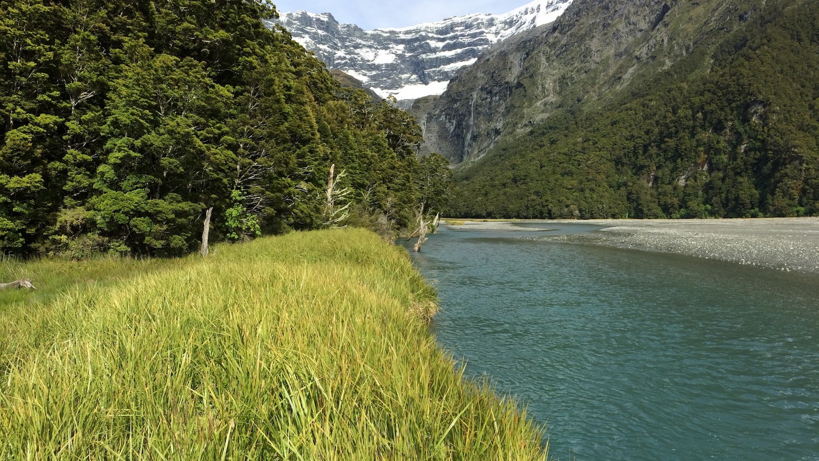
At 11 km’s, you reach the Kitchener river tributary and turn left to follow it up stream. You can walk down onto the river rocks and look up stream to catch your first glimpse of the mountains up the valley. From here it’s 2 km’s of slight uphill through the trees to Aspiring Flats. At 13 km’s the trees will yield to an expanse of bog, river braids and sand banks.
 First view when emerging onto Aspiring Flats
Take a breather here to admire the vastness and savor the solitude. Congratulate yourself on being able to follow the marked trail. Take off your shoes because there is a bog just ahead. Don’t waste time trying to skirt it. Look for sandy bottom in the water because you will sink quite deep stepping on underwater vegetation. Stay on the grass and sand as long as possible, avoiding the brush. When the bank ends, put on long sleeves and long pants because you’ll be bush bashing from here.
 The bog! Lose the shoes
Always stay as close as possible to the river bank. I made the mistake of bashing uphill thinking it would be drier. It’s much boggier inland. Take advantage of the flax grass meadows when you see them for easier travel. Eventually you will see a rocky beach on the river bank with a cairn. There will also be some red tape on a branch informing you that it’s time to go inland and uphill. From here it’s only 30 meters to the Rock of the Ages bivvy with good shelter, seating, a fire pit, some foam to sit on and a shovel with a really awesome handle. Congrats!
 Use flax grass banks for avoid having to bush bash
 Very bad pic of the destination: Rock of the Ages bivvy