Shade Map Pro
tl;dr Shade Map continues to be free for anyone, but a new paid tier provides the latest map data and additional features. See screenshots or read on for more detail
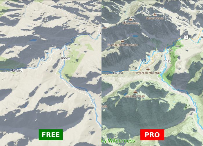
Pro includes elevation contour lines and 3D terrain
My hope is to democratize software. I admire how open source software has leveled the playing field between corporations and solo entrepreneurs. Websites like Wikipedia and MDN provide free, valuable information to anyone with an internet connection. Similarly, I’ve aspired to make Shade Map free as an educational resource and as a tool to improve people’s lives.
That being said, there are some technologies Shade Map relies on that are not yet freely or easily available. Among these are up-to-date map tiles, high quality elevation data and 3D terrain rendering.
For the past year I have relied on Mapbox and Mapbox GL JS for these features and although it offers a generous free tier, Shade Map is now exceeding it. In order to keep costs from ballooning, I switched from Mapbox to self hosting map data in February 2022. This allows Shade Map to operate at a predictable, fixed cost regardless of future growth. Anyone can continue using Shade Map for free.
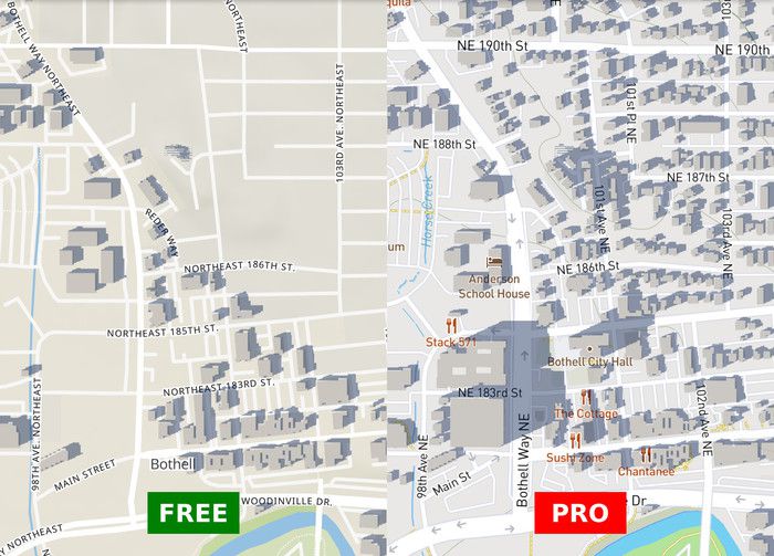
Pro includes up-to-date building data
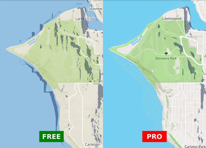
However, the free experience no longer contains the most up to date map and building data (it’s now from 2017), it lacks elevation contour lines, contains some erroneous elevation data and can no longer render terrain in 3D. While I search for low cost solutions to these issues, I wanted to offer an option to maintain the same high-quality data users have experienced in the past.
Starting today, users can pay $2 for 30 days or $5 for 90 days of Shade Map Pro (I use Stripe as my payment processor). Pro continues to source high quality data from Mapbox. Pro users are emailed an access link valid for the period of time they pay for. Each Pro payment is one-time. No auto-renewals or surprise recurring payments. Also, no account creation is required, just an email address where I can send an access link. (There is an implicit trust here that Pro links are not shared publicly and I’ll reassess if this becomes an issue.)
Pro provides cleaned up elevation data
I’d also like to thank OpenStreetMap, Nextzen, OpenMapTiles, MapLibre and Mapbox for providing an ecosystem that allows me to make Shade Map available to everyone at a modest cost. Also a shout out to Cloudflare and Linode for affordable hosting options.


