ShadeMap 2021 Wrap Up

Development #
A big change happened this fall. Right around the one-year mark I finally succeeded in migrating Shade Map (shademap.app) onto a vector based map. Up until this point I used tiled image maps which downloaded many small, square image tiles and stitched them together. Vector based maps instead download lists of GPS coordinates and use these coordinates to draw the roads, buildings and contour lines in the browser. Because the data is drawn on the fly, you can choose to draw the map with south pointing up. Or you can draw the map as if it’s tilted at 45 degrees. So Shade Map can now be rotated and viewed in 3D perspective, just like Google Maps. Here’s a demo I posted on Twitter at the time:
Finally ported https://t.co/I2lujZ4zou to @Mapbox GL and it is beautiful! #gis #topography #cartography #maps pic.twitter.com/OURJAbboYn
— truted (@truted2) December 2, 2021
The other major change was to the time/date slider. Previously the slider was a basic form slider with emojis indicating sunrise and sunset:
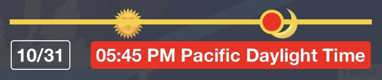
This type of slider was easy to use precisely with a mouse but on phone screens it became bunched and hard to drag to an exact minute. The solution I came up with was to let the slider extend past the edges of the screen. This way the distance the time slider had to be moved was the same regardless of the screen size. I also replaced the sunrise and sunset emojis with a solid yellow line to indicate daylight hours:

Traffic #
Another consequence of migrating to vector maps was that I no longer had to pay for individual map tiles. Looking at past invoices, November had become my most expensive month where 3,000 visitors managed to download 1,077,040 tiles at a cost of $82. My new vector based map no longer required map tiles and allowed 50,000 map loads for free. I switched to the vector map in December thinking I wouldn’t need to pay anything for a while.
But my December bill was for $145. Visitors had loaded the map 78,504 times that month. What happened? Three major events. The first was that tweet at the beginning of this blog. It was retweeted by some employees at Mapbox and was seen by about 5,000 people. This resulted in Shade Map being mentioned on some mapping blogs and newsletters. The OSINT community (which I had never heard of) also shared it around as a means to reverse-engineer the time and location of photographs.
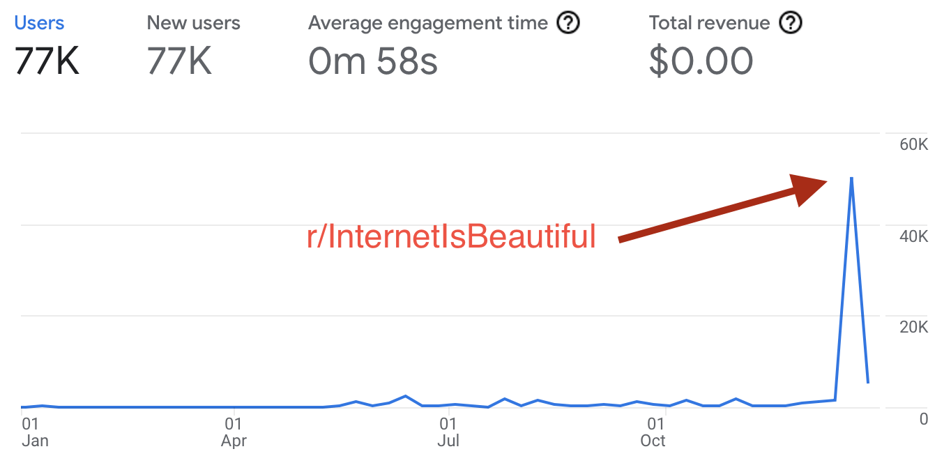
The second event happened on Christmas eve when someone posted Shade Map in r/InternetIsBeautiful. The subreddit is massive. In the first hour it drove 3,000 visitors, which was more than the whole month of November. After a day it had easily eclipsed all the traffic Shade Map managed to generate for the rest of 2021.
The third traffic spike came from Shade Map getting a mention in the At Home And Away Newsletter which is published by the New York Times. It was also the Reader’s Best of 2021 issue. This experience and when Shade Map appeared in a Nature newsletter a few months back, I’m suspecting that things which appear in print are more and more often being skimmed off popular Reddit threads.
Business #
A lot more inbound mail this fall asking about integrating Shade Map into their projects. I even sent out about a half dozen API keys. Most are just hobby projects or small scale demos which I don’t think will convert to a paid plan. But I did also manage to get noticed by people working at popular map/outdoor app companies. Here’s was the main takeaway:
a web based product is not enough, it also needs to work natively on mobile
I understand this point of view. Many of these companies run the web version of their products for free and then charge to download it as an app. At this point I think it’s my best move to build a mobile app, both to understand how to integrate Shade Map into other mobile apps and also because with the amount of visitors the site’s receiving lately I can potentially list it for sale myself.
The End #
2021 was a great year. I got to spend a lot of time outdoors, but also built a modest following for Shade Map. It went from a barely usable proof-of-concept to something that people are eagerly sharing online. I’m excited for the technical challenges ahead so it’s time to get busy in 2022! Thanks for reading.